Which zone are you in? We are in above normal of course, not happy, hoping it gets warmer drier, NOT for the DRY areas, but in the NE.
-
Which zone are you in? We are in above normal of course, not happy, hoping it gets warmer drier, NOT for the DRY areas, but in the NE. -
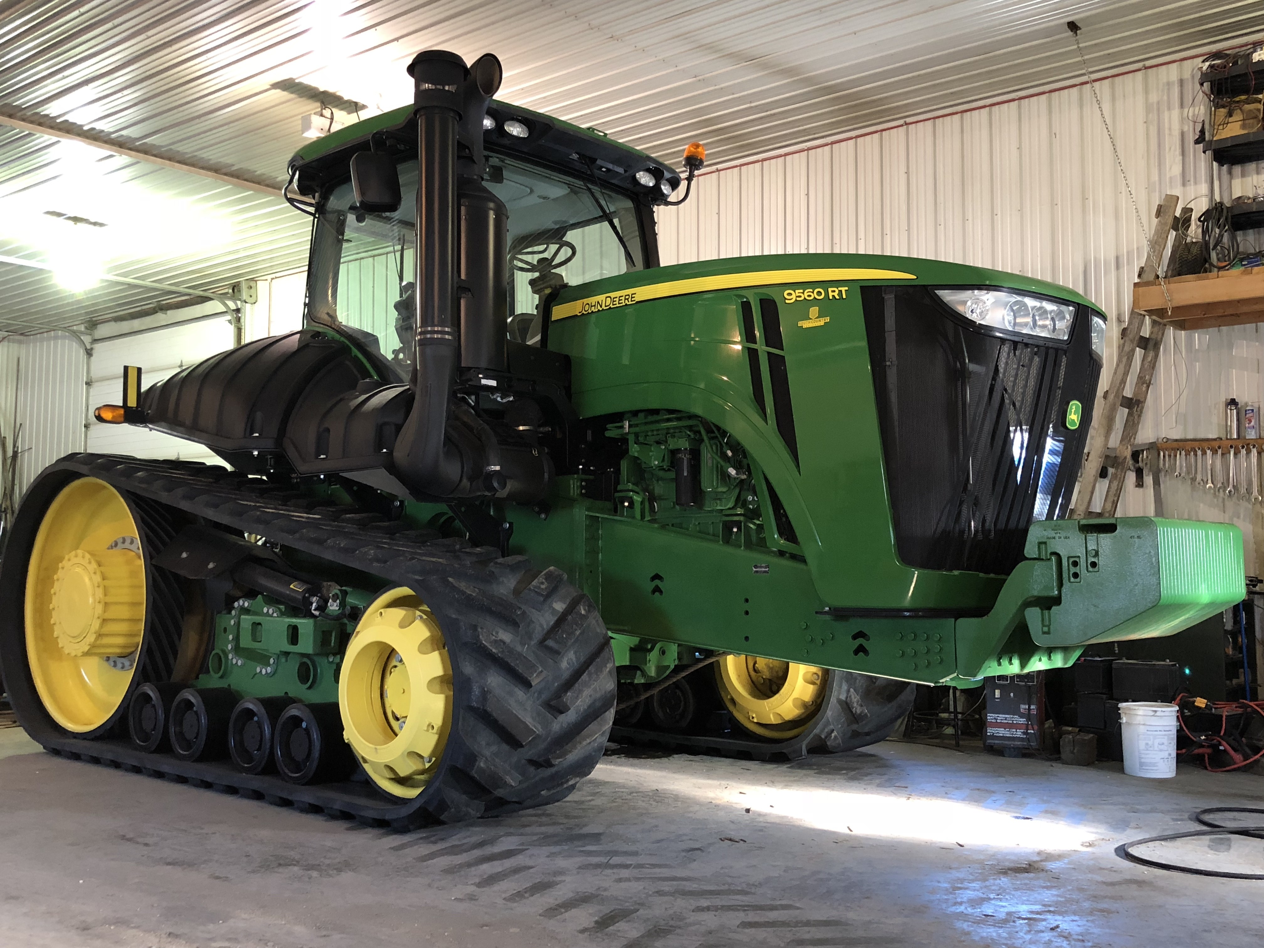
Green just like my JD machines
Comment
-
Hey sf3 nice ride but it needs a couple more tracks to play with all the cool kids
Comment
-
If you have not seen this...
Here is the 2018 Pig Spleen Weather ForecastðŸ·
Forecast this year is based on spleens from Hazlet,Saskatchewan.
The spleen prognostication was completed on December 20th 2017 in Regina and then shared the predictions at the Pig spleen prognostication Party which was held on a bitterly December 29 cold night at the Collier farm at Gull Lake Saskatchewan,with Megan Nash entertaining us🎸.
The free range pigs had lots of fat on them this year; two spleens showed signs of being very cold with lots of snow and two spleens showed cold with snow .
The 2018 winter will be colder than normal with above average snowfall and some big winds.
Drastic temperature swings should be more pronounced than normal as we go from frigid cold, to above normal temps Over the winter months.
The end of December is very cold which will persist into the new year.
Temperatures will start to improve in the new year with a short period of warm temperatures and sun🌞 but it will be interspersed With periods of very cold.
Temperatures will remain below average until mid-March with a few exceptions at the middle and the end of February. Significant snowfall will occur towards the end of January and at the end of February and the start of March. Temperatures will start to be above average for the last half of March and then gradually return to below average all the way through April and May.
It looks like there will be a big run off at the end of March but the cooler temperatures will cause it to slowly dissipate. There will be good precipitation around March 20 and April 5-7, and at the end of April.
June will be an average month in general.
Significant fog events indicate precipitation middle and the end of January and also the middle and the end of February. Possibility of sleet and rain in January.
This year there will be a lot of wind particularly in the south west where temperatures and wind chills will be harsh.
There should be good snow moisture allowing for a good spring germination, however crops need to be seated early to take full advantage of this, otherwise the dry summer will be hard on crops.
January
The end of December will be very cold leading into January and weather will improve into January with the period of warm temperatures, however they will return to below normal mid month. There will be a brief warm trend middle of the month between January 16 and 22nd and then temperatures will dip back below normal. Expect snow at this time. Temperatures will decline towards the end of the month and into February. Expect some snow on January 5 and between January 18 and the 20th with most of it coming around January 18 in a winter blizzard with high winds. January will be a month of extremes in temperature from warm to cold. Watch for extreme icy conditions particularly in the centre and eastern part of the province .
February
The end of January is colder than normal with temperatures falling into into the beginning of February. Temperatures will rebound around February 11 (-2 To -10 in the daytime) For a short time but then dip again to below normal for about a week. Around February 20th there will be a period of about a week which is above normal temperatures (0 to -5 daytime) and then drop a game into March. Precipitation will occur on February 11 and then again between the 20th and the 22nd. The end of February and the beginning of March will see above average precipitation.
March
The beginning of March will be colder than normal but will gradually improve over the entire month. Temperatures will begin to be above average starting around March 14 (+2 daytime range ) Temperatures will remain above average and improve for the last half of the month. Expect snow on March 3 and March 20th. The temperature swings in March will be fairly extreme and will bring a lot of wind.
April
The end of March will be generally warmer than average, however this will not last until April. April will start off around average temperatures(+5 daytime) but will drift towards below average and significantly below average over the month. Then at the end of the month will be below average with daytime temperatures around +10. April will see above average precipitation around April 5-7 and also at the end of the month around the 22nd to 25th.
May
May will continue to be below average for most of the month. Temperatures will continue To decline below average until mid-May when they will stabilize. Daytime temperatures at the end of the month Will be in the 15 to 20° range. Expect good precipitation at the very start of the month and also around May 21. At the very end of May there will be an abrupt warming when temperatures will return to average for June.
June
Temperatures in June will be above average in general. Daytime temperatures will be 21 to 23 and warming at the end of the month. There will be some participation at the start of June, around the second, however after that there is no significant precipitation.
*If the weather did not change as much as it does, nine out of 10 Canadians would have nothing to talk about.
Thanks for your interest,
Your Pig Spleen Prognosticator,
Jeff Woodward.Comment
- Reply to this Thread
- Return to Topic List
Comment